- Browse
- Gis
Results for "gis"
 Status: Free TrialFree TrialU
University of California, Davis
Skills you'll gain: ArcGIS, GIS Software, Geographic Information Systems, Data Sharing, Spatial Analysis, Metadata Management, Data Quality, Data Visualization, Data Visualization Software, Data Analysis, File Management
4.8·Rating, 4.8 out of 5 stars5.9K reviewsBeginner · Course · 1 - 4 Weeks
 Status: Free TrialFree TrialU
University of California, Davis
Skills you'll gain: ArcGIS, GIS Software, Spatial Analysis, Data Storytelling, Spatial Data Analysis, Geographic Information Systems, Data Presentation, Geospatial Information and Technology, Geospatial Mapping, Public Health and Disease Prevention, Data Sharing, Public Health, Land Management, Heat Maps, Epidemiology, Community Health, Image Analysis, Project Management, Data Visualization Software, Data Quality
4.8·Rating, 4.8 out of 5 stars6.4K reviewsBeginner · Specialization · 3 - 6 Months
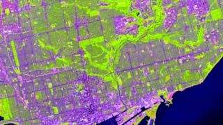 Status: Free TrialFree TrialU
University of Toronto
Skills you'll gain: ArcGIS, Spatial Data Analysis, Spatial Analysis, Geographic Information Systems, Geospatial Mapping, GIS Software, Data Mapping, Geospatial Information and Technology, Data Visualization, Metadata Management, Query Languages, Global Positioning Systems, Quantitative Research, Data Compilation, Typography, Data Manipulation, Data Storytelling, Data Modeling, Design Elements And Principles, Image Analysis
4.8·Rating, 4.8 out of 5 stars3.1K reviewsBeginner · Specialization · 3 - 6 Months
 Status: Free TrialFree TrialU
University of Toronto
Skills you'll gain: ArcGIS, Spatial Data Analysis, Geographic Information Systems, Spatial Analysis, Geospatial Mapping, Data Mapping, Global Positioning Systems, Data Capture
4.8·Rating, 4.8 out of 5 stars2.3K reviewsBeginner · Course · 1 - 3 Months
 Status: Free TrialFree TrialU
University of Michigan
Skills you'll gain: Sustainable Development, Geographic Information Systems, Geospatial Mapping, Sustainability Reporting, Spatial Data Analysis, Sustainable Business, Spatial Analysis, Data Storytelling, Environmental Monitoring, Data Visualization, Stakeholder Engagement, Trend Analysis, Decision Making
4.5·Rating, 4.5 out of 5 stars17 reviewsBeginner · Course · 1 - 4 Weeks
 Status: Free TrialFree TrialU
University of California, Davis
Skills you'll gain: ArcGIS, Data Storytelling, Spatial Data Analysis, Data Presentation, Geographic Information Systems, Spatial Analysis, Geospatial Mapping, Heat Maps, Data Visualization Software, Network Analysis, Data Manipulation
4.5·Rating, 4.5 out of 5 stars120 reviewsIntermediate · Course · 1 - 4 Weeks
What brings you to Coursera today?
 Status: FreeFree
Skills you'll gain: ArcGIS, Data Presentation, GIS Software, Spatial Data Analysis, Data Visualization, Geographic Information Systems, Geospatial Information and Technology, Geospatial Mapping, Data Import/Export, Data Mapping, Data Integration, Data Management
4.5·Rating, 4.5 out of 5 stars13 reviewsIntermediate · Guided Project · Less Than 2 Hours
 Status: Free TrialFree TrialL
L&T EduTech
Skills you'll gain: Spatial Analysis, GIS Software, Spatial Data Analysis, Geospatial Mapping, Geographic Information Systems, Building Information Modeling, Data Manipulation, Global Positioning Systems, Network Analysis, Image Analysis, Data Import/Export, Unsupervised Learning, Software Installation, Supervised Learning, UI Components
4·Rating, 4 out of 5 stars44 reviewsAdvanced · Course · 1 - 3 Months
 Status: Free TrialFree Trial
Skills you'll gain: Generative AI, ChatGPT, Real Time Data, Artificial Intelligence and Machine Learning (AI/ML), AI Personalization, Machine Learning
4.6·Rating, 4.6 out of 5 stars4.2K reviewsBeginner · Course · 1 - 4 Weeks
 Status: Free TrialFree TrialU
University of Toronto
Skills you'll gain: Geographic Information Systems, GIS Software, Spatial Analysis, Spatial Data Analysis, Geospatial Information and Technology, Geospatial Mapping, Query Languages, Data Manipulation, Image Analysis
4.9·Rating, 4.9 out of 5 stars627 reviewsBeginner · Course · 1 - 3 Months
 Status: Free TrialFree TrialU
University of California, Davis
Skills you'll gain: ArcGIS, Geographic Information Systems, Public Health and Disease Prevention, Public Health, Land Management, Geospatial Information and Technology, Geospatial Mapping, Spatial Analysis, Epidemiology, Community Health, Spatial Data Analysis, Social Determinants Of Health, Emergency Response, Environmental Science, Natural Resource Management, Emergency Services, Business Development, Environment and Resource Management, Hazard Analysis, 3D Modeling
4.6·Rating, 4.6 out of 5 stars89 reviewsIntermediate · Course · 1 - 4 Weeks
 Status: PreviewPreview
Skills you'll gain: Geographic Information Systems, Geospatial Mapping, Spatial Data Analysis, Spatial Analysis, Global Positioning Systems, Data Analysis, Metadata Management, Decision Support Systems
4.7·Rating, 4.7 out of 5 stars24 reviewsIntermediate · Course · 1 - 4 Weeks
What brings you to Coursera today?
In summary, here are 10 of our most popular gis courses
- Fundamentals of GIS: University of California, Davis
- Geographic Information Systems (GIS): University of California, Davis
- GIS, Mapping, and Spatial Analysis: University of Toronto
- Introduction to GIS Mapping: University of Toronto
- GIS: Geographic Information Systems for Sustainability: University of Michigan
- Geospatial Analysis with ArcGIS : University of California, Davis
- ArcGIS for Beginners: Mapping Urban Green Spaces: Coursera
- Mastering Geospatial Analysis with QGIS: L&T EduTech
- Generative AI: Introduction and Applications: IBM
- Spatial Analysis and Satellite Imagery in a GIS: University of Toronto
Frequently Asked Questions about Gis
Geographic Information Systems (GIS) is a technology that enables the collection, analysis, and visualization of spatial and geographic data. It plays a crucial role in various fields, including urban planning, environmental science, and disaster management. By integrating data from different sources, GIS helps in making informed decisions, optimizing resources, and understanding complex spatial relationships. Its importance lies in its ability to provide insights that can lead to better planning and management of resources, ultimately contributing to sustainable development.
A career in GIS can lead to various job opportunities across multiple sectors. Common roles include GIS Analyst, GIS Technician, Cartographer, and Urban Planner. Additionally, positions such as Environmental Consultant and Spatial Data Scientist are increasingly in demand. These roles often involve using GIS tools to analyze data, create maps, and support decision-making processes in organizations. The versatility of GIS skills allows professionals to work in government agencies, private companies, and non-profit organizations, making it a valuable field for those interested in geography and technology.
To succeed in GIS, you will need a combination of technical and analytical skills. Key skills include proficiency in GIS software (such as ArcGIS or QGIS), understanding spatial data formats, and knowledge of cartography principles. Additionally, skills in data analysis, programming (often in Python), and database management are beneficial. Familiarity with remote sensing and spatial analysis techniques can also enhance your capabilities. Developing these skills will empower you to effectively analyze geographic data and contribute to various projects.
There are several excellent online GIS courses available that cater to different skill levels and interests. For beginners, the Fundamentals of GIS course provides a solid foundation in GIS concepts and applications. For those looking to specialize, the Geographic Information Systems (GIS) Specialization offers a comprehensive curriculum covering advanced topics. Additionally, the GIS, Mapping, and Spatial Analysis Specialization is ideal for learners interested in spatial analysis techniques.
Yes. You can start learning GIS on Coursera for free in two ways:
- Preview the first module of many gis courses at no cost. This includes video lessons, readings, graded assignments, and Coursera Coach (where available).
- Start a 7-day free trial for Specializations or Coursera Plus. This gives you full access to all course content across eligible programs within the timeframe of your trial.
If you want to keep learning, earn a certificate in GIS, or unlock full course access after the preview or trial, you can upgrade or apply for financial aid.
To learn GIS effectively, start by identifying your learning goals and the specific areas of GIS that interest you. Begin with introductory courses like the Fundamentals of GIS to build a solid foundation. As you progress, consider more specialized courses that align with your career aspirations. Engage in hands-on projects to apply what you learn, and seek out community forums or study groups for support. Consistent practice and real-world application will enhance your understanding and confidence in using GIS.
Typical topics covered in GIS courses include spatial data analysis, cartography, remote sensing, and GIS software usage. Courses often explore data acquisition methods, map design principles, and the application of GIS in various industries. Additionally, learners may study geographic data formats, spatial modeling, and the integration of GIS with other technologies. This comprehensive curriculum equips learners with the knowledge and skills necessary to tackle real-world challenges using GIS.
For training and upskilling employees, courses like the GIS Applications Across Industries are particularly beneficial. This course provides insights into how GIS can be applied in different sectors, enhancing employees' ability to leverage GIS tools effectively. Additionally, the GIS, Mapping, and Spatial Analysis Capstone offers a practical project that can help teams apply their skills in real-world scenarios, making it an excellent choice for workforce development.


