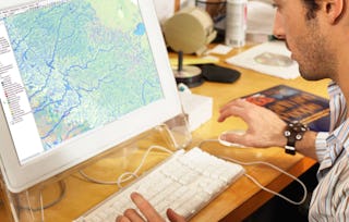
The world is currently experiencing complex challenges in social, economic, and environmental sustainability. Geographic information systems (GIS) help us organize, analyze, and display large spatial datasets that reveal critical spatial and temporal patterns crucial for addressing these complex issues.

GIS: Geographic Information Systems for Sustainability
Ends soon: Gain next-level skills with Coursera Plus for $199 (regularly $399). Save now.

GIS: Geographic Information Systems for Sustainability
This course is part of Green Skills for a Sustainable and Just Future Specialization


Instructors: Kim Diver
2,075 already enrolled
Included with
(16 reviews)
Recommended experience
What you'll learn
Learn how GIS are used for solving complex environmental and sustainability problems
Analyze spatial data to visualize and assess sustainability issues
Learn to engage stakeholders using geospatial visualizations
Gain insight on the importance of GIS for environmental decision-making
Skills you'll gain
Details to know

Add to your LinkedIn profile
4 assignments
See how employees at top companies are mastering in-demand skills

Build your subject-matter expertise
- Learn new concepts from industry experts
- Gain a foundational understanding of a subject or tool
- Develop job-relevant skills with hands-on projects
- Earn a shareable career certificate

There are 4 modules in this course
Welcome to Module 1. This module introduces the course, including the instructors and the layout of the course. You will learn what GIS is and how GIS can be used to monitor, identify, and assess sustainability issues. You will hear about the relevance of GIS to environmental sustainability efforts from guest interviewees. Through a demonstration video, you will be exposed to some leading GIS software applications. The Skill Building Exercises focus on orienting you to basic map functionality and discerning spatial patterns in real-world datasets.
What's included
5 videos11 readings1 assignment1 app item2 discussion prompts
In Module 2, you will explore how GIS is used to identify trends and perform forecasting related to issues of sustainability. You will hear from two GIS professionals about the intersection of GIS and sustainability in their work. And you will learn about map design best practices, especially regarding which data to use and how to present data in ways that highlight patterns or trends. In the Skill Building Exercises, you will hone skills built in the previous module, gain proficiency with near real-time datasets, and analyze spatiotemporal trends through data filters.
What's included
3 videos3 readings1 assignment1 app item1 discussion prompt
Module 3 introduces the utility of GIS to optimize planning and decision-making, implement sustainable solutions, and enhance community awareness. You will learn how different types of thematic maps can help visualize geographic data. You will hear from GIS professionals about the importance of GIS to their environmental sustainability research. In the Skill Building Exercise you will develop skills in multi-criteria analysis and suitability mapping using overlay analyses.
What's included
2 videos3 readings1 assignment1 app item1 discussion prompt
Module 4 emphasizes the utility of GIS to engage stakeholders, empower communities, and create compelling narratives. You will hear from sustainable leadership and GIS professionals about the relevance and future of GIS in sustainability engagement. You will learn about different map use environments. The Skill Building Exercises focus on how digital storytelling combined with spatial analyses through story maps can increase accessibility of complex sustainability issues.
What's included
4 videos4 readings1 assignment1 app item1 discussion prompt
Earn a career certificate
Add this credential to your LinkedIn profile, resume, or CV. Share it on social media and in your performance review.
Offered by
Explore more from Data Analysis
 Status: Free Trial
University of California, Davis
 Status: Preview
 Status: Free Trial
University of California, Davis
 Status: Free Trial
L&T EduTech
Why people choose Coursera for their career


Learner reviews
16 reviews
- 5 stars
64.70%
- 4 stars
23.52%
- 3 stars
5.88%
- 2 stars
5.88%
- 1 star
0%
Showing 3 of 16
Reviewed on Aug 9, 2025
Amazing course with insightful interviews. highly recommended
Frequently asked questions
To access the course materials, assignments and to earn a Certificate, you will need to purchase the Certificate experience when you enroll in a course. You can try a Free Trial instead, or apply for Financial Aid. The course may offer 'Full Course, No Certificate' instead. This option lets you see all course materials, submit required assessments, and get a final grade. This also means that you will not be able to purchase a Certificate experience.
When you enroll in the course, you get access to all of the courses in the Specialization, and you earn a certificate when you complete the work. Your electronic Certificate will be added to your Accomplishments page - from there, you can print your Certificate or add it to your LinkedIn profile.
Yes. In select learning programs, you can apply for financial aid or a scholarship if you can’t afford the enrollment fee. If fin aid or scholarship is available for your learning program selection, you’ll find a link to apply on the description page.
More questions
Financial aid available,


